|
The
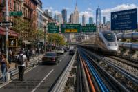
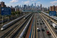
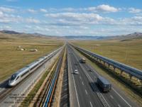
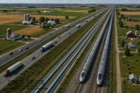
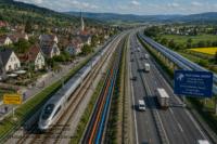
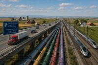
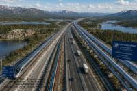
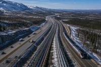
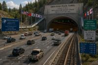
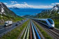
Trans Global Highway
The Trans Global
Highway will physically link all continents and major population
centers, including Australia by roadways, railroads, magnetic
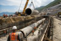
levitation (mag-lev) trains, water pipelines, oil and gas pipelines,
and communication cables.
The
Trans Global Highway will create a world wide network of
standardized roads, railroads, water pipe lines, oil and gas
pipelines, electrical and communication cables. The result of this
remarkable, far sighted project will be global unity through far
better distribution of resources, including heretofore difficult to
obtain or unaccessible raw materials, fresh water, finished products
and lower global transportation costs.
If all goes
according to plan, we expect the Trans Global Highway to be completed
by 2043.
From a
human point of view, the advantages of the Trans Global Highway are
enormous. First, it will allow rapid transport of raw materials and
finished goods from near and far. In addition, the Trans Global
Highway will offer a conduit for gas, oil and water pipelines, as
well as communication and electric power cables. It should be noted
that fresh water is a major issue among arid areas, throughout the
world, including the Middle East, western United States, Africa and
Central Asia.
The Trans
Global Highway combined with water pipelines from areas of abundance
to arid areas, will benefit humankind even more. Perhaps there is a
solution to the theoretical threat of global flooding from melting
land ice at the poles, that some people fear.
The Trans Global
Highway should be viewed similar to the Space Moon race between
Russia and the United States, except in stead of spending vast
amounts of money for county glory, the Trans Global Highway will
benefit all of human kind for generations to come.
With greatly expanded global fresh water distribution, arid lands
could be cultivated resulting in a huge abundance of global food
supplies. The most conservative estimate is that with the
construction of the Trans Global Highway, the planet will be able to
feed several billion more people, using presently available modern
farming technologies. With the present global population of just
under 7 billion people and at the United Nations projection of
population increase, the world will produce enough food surpluses to
feed the expected increased population for several hundred years.
The Trans
Global Highway will undoubtedly increase global security through
mutually dependent trade and commerce. As with almost all major
public works projects, such as the Suez Canal, the Panama Canal, the
Chunnel, the Alaska Pipeline and others, many people did argue that
the tunnels, bridges and roads were not necessary.
Today some
may present counter arguments stating that existing air and sea
transport is just fine. Further, the cost may at first, may seem
astronomical, but in retrospect, every one of these visionary
projects has greatly helped mankind in commerce and progress.
Ultimately, the Trans Global Highway will be constructed, in one form
or the other, but we have an opportunity to start with, at least the
ground work of planning, today. The primary obstacles, are not
technical, and not even financial, even though the costs may seem
high. The real obstacle to the construction of the Trans-Global
Highway is political. Many bordering countries are presently at odds
with one another, and may not be willing to allow a free moving
highway to run through their territories, even with the potential of
vast economic benefits.
The Trans Global Highway will greatly increase the overall global
standard of living and would alleviate certain fears regarding over
population and limited resources. The Trans Global Highway will be
able to quickly distribute the resources from one part of the world,
to another.
The fact is that the Trans Global Highway will revolutionize the
world. Whole new industries would develop as a result of the Trans
Global Highway. Products that in the past were too expensive to
transport great distances, could suddenly have new markets opening
up. Heavy farm equipment could be transported from one area to
another, depending on the planting season. Water and natural
resources, that in the past were too far or isolated from urban
areas, can suddenly be transported around the world. Electrical power
plants could be situated in remote areas of the world, far away from
large urban cities and the concerns that some people may have about
them. the advantages to human kind is endless and will benefit the
world for centuries to come.
Political
issues
It
is true that many of the countries that will be the primary corridor
for the Trans Global Highway are competitors, or are at war with one
anther or have long standing historic issues with one another.
History has shown that over time, countries that are enemies have
become closest partners. For example, just 80 years ago, the United
States and Germany and Japan were bitter enemies, but to day the
three countries are close allies. Going back much further, the
thirteen colonies had a bitter, bloody eight year war with England,
yet a century later, the USA and the UK are also close friends. It is
fully expected that countries will set aside their differences and
allow the Trans Global Highway to be built and this will ultimately
serve all of human kind.
Why
Build the Trans Global Highway?
-
Unifying
human kind.
- Linking
people and linking society by land,for the very first time in eons.
- Enhance
access to natural resources including minerals, fuel, lumber, water,
remote power generation areas.
- Water
pipelines to irregate arid areas
- Open
up large areas to potential farming.
- Reduce
over population concerns.
- Alleviate
the effects of potential global warming.
- Reduce
transportation costs
- Reduce
transportation time
- Every
country and every culture will benefit from the highway for
centuries to come. When completed, people will wonder how come it was
not built earier.
Ownership
and How Will It Be Maintained? No
single nation needs to own the Trans Global Highway, however each
nation will retain their sovereignty over its own territory and
infrastructure. The maintenance of the Trans Global Highway will be
funded by reasonable tolls from the road highway, portions of trains
and or mag-lev transit fees and tolls for the gas, oil, water,
electrical cable and communication cable transit. Similar toll
schemes already exist throughout the world. Certain areas of the
Trans Global Highway will require more funds to maintain the pathway
and thus there will be an equitable method of sharing certain tolls
to offset the addition funds needed to maintain those areas.
The
Tans Global Highway will be governed as outlined in the Trans Global
Highway Charter. TGHW
CHARTER
Technical
Feasibility
All aspects of the
technology needed to build the Trans Global Highway is fully
understood and has already been developed and thus the can be built
right now, with the technology of today,
utilizing the engineering, materials and technology of today.
The Trans Global Highway is economically viable and will revitalize
business and all social aspects of society. The major reason slowing
down the project is not technical, but rather political.
Most
cross water connections, particularly cross ocean connections in
remote areas, will be tunnels rather than bridges, since being
underground will protect such crossings from the elements. Certain
roads in areas of heavy snow, or environment will be built raised off
of the ground or covered. Being elevated above ground will also allow
wildlife to pass under the pathway.
It is interesting to note the major tunnels and bridges in
existence. Most of these tunnels are in fact longer than the longest
proposed tunnel needed to complete the Trans Global Highway.
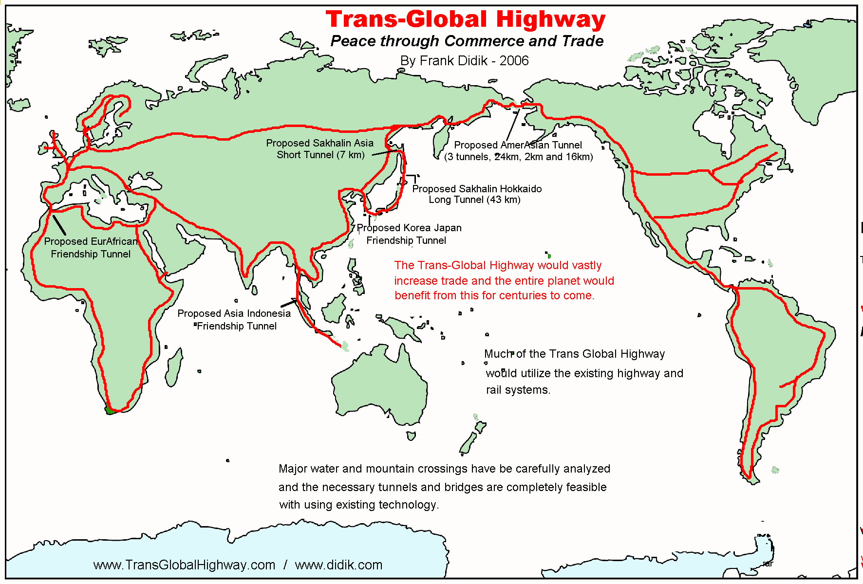
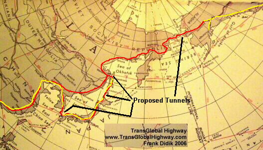
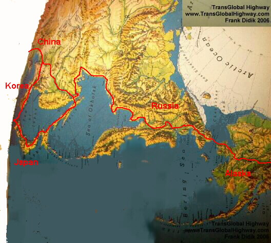
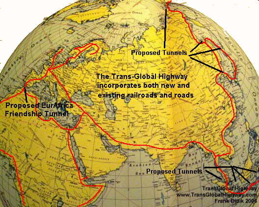
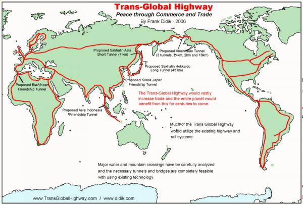
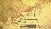
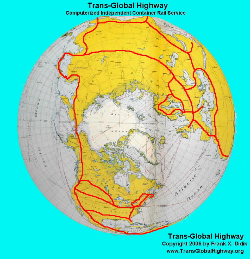
The road outlines are tentative and are designed to utilize the
existing highway grid. Thus many more arteries than illustrated
above, would be connected to the backbone of the Trans Global
Highway. Not clearly shown in the map above is that North America and
Asia are to be connected by the Bering Strait Tunnel. NOTE: This has
to be one of the most copied Frank Didik maps on the internet. Many
other maps has used this map as their template.

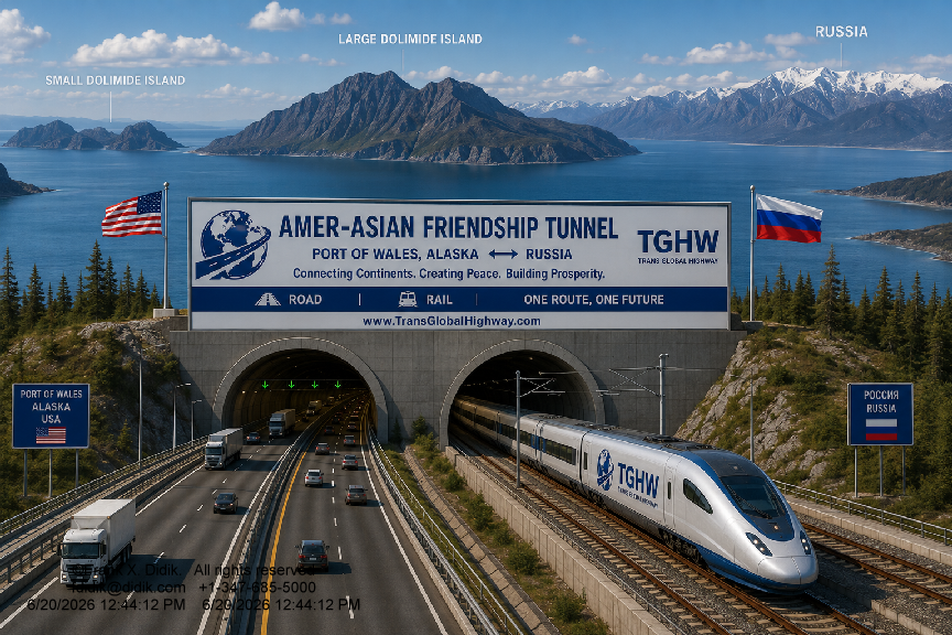
How
it may look in a few years
The
AmerAsian Peace Tunnel
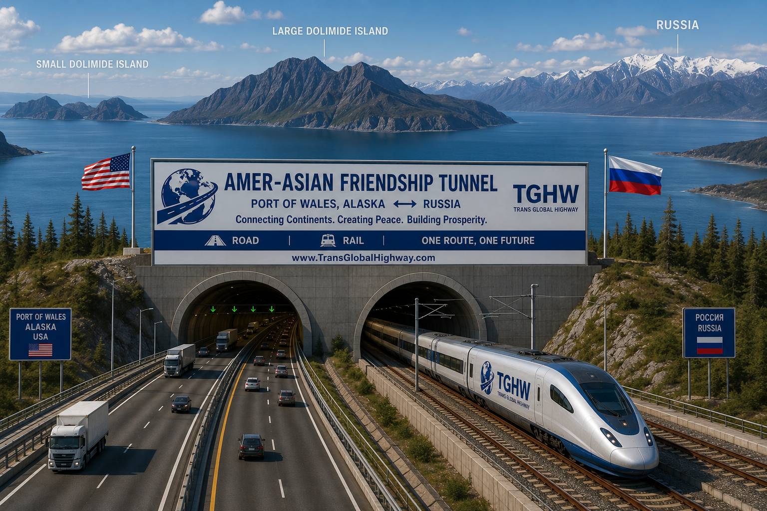
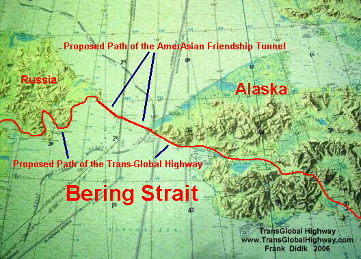
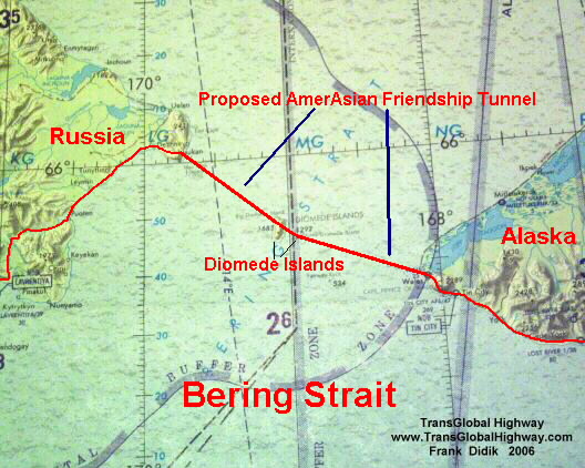
The AmerAsian
Peace Tunnel (Bering Strait tunnel) will consist of 3 tunnels
connecting Alaska and Russia by going through two islands (the Little
Diomede(USA) and Big Diomede (Russia)). The longest single tunnel
will be 24 miles in length.
Since the
Bering Sea, at the crossing point has a maximum known depth of only
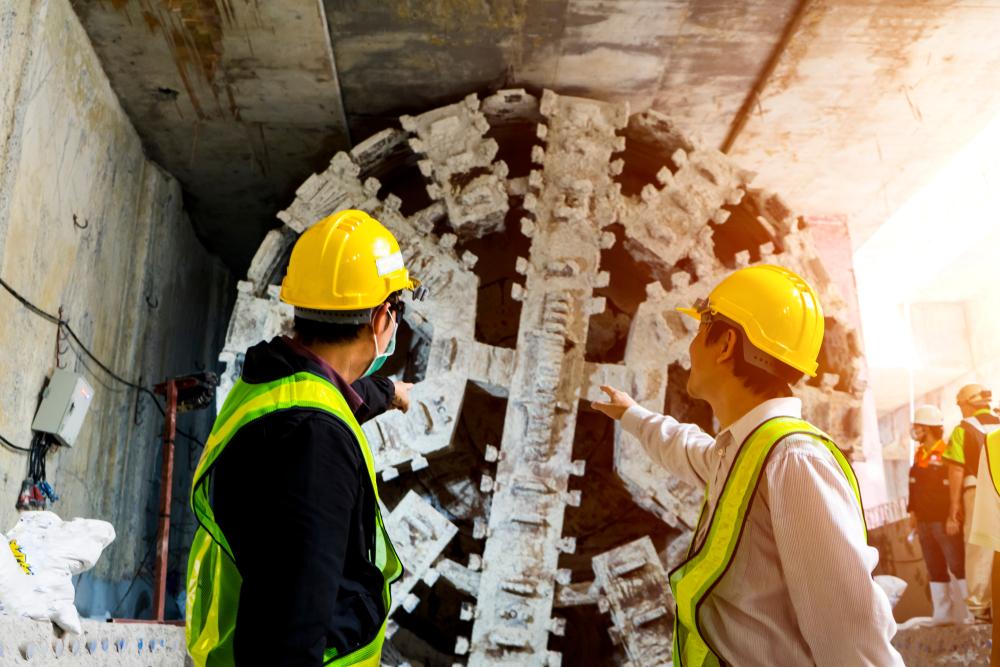
170 feet, the tunnel will be dug using conventional, modern tunnel
boring machines, of the type that was employed in the construction of
the Chunnel and many other tunnels around the world.
The three
tunnels is be much better than a bridge for a variety of reasons
including that fact that during the winter months, the Bering Strait
is iced over and a bridge would be subject to sever environmental
conditions. Further, in most cases, tunnels are both less expensive
to construct and cost less to maintain. Suspended under water tunnels
are not suggested for this crossing, because of the shallow depth of
the Bering Strait.
The
AmerAsian Peace Tunnel will start on the US side, from the town of
Cape Prince of Wales, which has a population of 156 and about 80
buildings, including a large school, streets and general store, and
end at the Russian settlement of Naukan or 2 km north at the Dezhnev
settlement. The tunnel will pass through both Little and Big Diomede
islands which can be used for ventilation shafts and possibly as a
relief station.
Both Little
Diomede (USA) and Big Diomede (Russia) have been occupied for
hundreds of years. Little Diomede has a Inalik native village with a
population of about 200 and has a high school, store, Post Office, a
community hall and many residences.
The terrain
of Cape Prince of Wales is very similar to the rolling grassy hills
of Scotland and the gentle hill ends at a flat area at the Bering
Strait with a very nice beach. The terrain of the Diomedes as well as
the Russian Asiatic mainland is similar to the fiords of Norway,
though the tops of the hills again are very similar to the rolling
grassy hills of Scotland. Archeological findings, date back to over
two thousand years.
There are
relatively flat areas along the coast of Russia, around the exit of
the tunnel, is ideally suited for a major highway and rail transport.
In the winter time, the surface of the Bering Strait is frozen and it
is possible to walk or even drive across the Strait, however, this is
very dangerous, not to mention that crossing will be going across
international borders. The tunnel will not be affected by the frozen
Strait and tunnels under similar conditions have been constructed
world wide.
|
State
of Alaska Photo
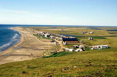
Cape
Prince Wales (USA), looking towards Russia, in the summertime. |
USGS
Photo
Big
Diomede (Russia) |
|
USGS
Photo

Asiatic
Russia, just past the Diomede, in summer. The green is enhanced. In
reality, the greenery is similar to Cape Prince of Wales, Alaska. |
USGS
Photo

Little
Diomede (USA) in the foreground. |
Path
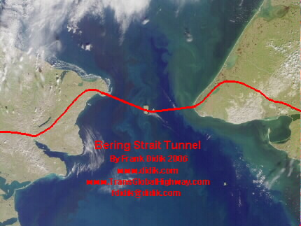
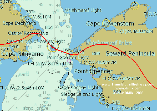
of the proposed AmerAsian / Bering Strait Tunnel
Click
on any photograph to enlarge. Use your back key to return to this
menu. (Please also view the more detailed maps, found on the column
to the right)
|
The
Bering Strait is named after Captain Vitus Bering of the Imperial
Russian Navy, who was sent by Peter the Great, in 1725, to explore
the ocean surrounding the eastern most reaches of Russia. |
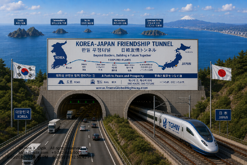
Japan will
be connected with mainland Asia via five tunnels extending from the
city of Fukuoka on Kyushu to the port city of Pusan in Korea via four
islands. The maximum ocean depth in this area is 480 feet.
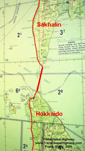
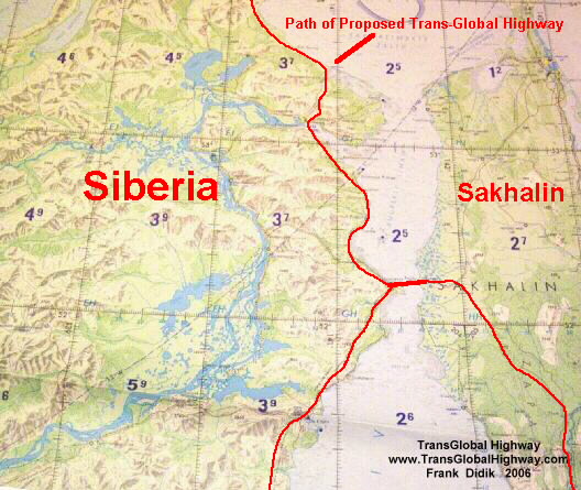
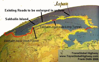
It is also
feasible to connect Japan to mainland Asia by constructing two
tunnels extending north from Hokkaido to Sakhalin Island, which will
be 25 miles (42km) long and a second tunnel from Sakhalin to the
Siberian Russian mainland, which will only be 4.2 miles (7km) long.
Recent
estimates are that as much as 20 million tons of goods, manufactured
in Japan will be shipped overland via the Russian railroad system,
bypassing the current costly shipping costs, that include transit
through the Suez Canal. There is a major financial incentive to build
the Hokkaido Sakhalin-Siberian tunnel.
It should
be noted that the Russian standard gauge railroad tracks have a
slightly higher gauge than the global standard. Thus the rails on the
Russian gauge tracks are approximately 8" (20cm) farther apart
than the rest of the standard gauge rails. This system was adapted to
have a wider footprint, to minimize sinking in the soft summer soil
in the tundra region (though some historians have also stated that
this "non-standard" was adapted to prevent foreign armies
from quickly using Russian tracks in the event of war. Prior to the
1905 Russo-Japan war, the Chinese railroads, which Russia built, also
used this wider gauge After 1905, when the Japanese took over the
Chinese rails, the Japanese rebuilt the rails to conform with the
global standard, which Japan had adapted.
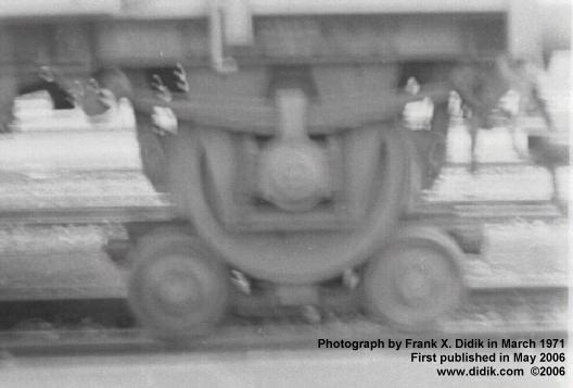
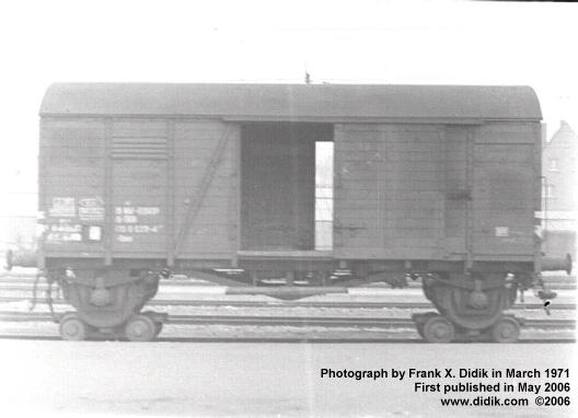
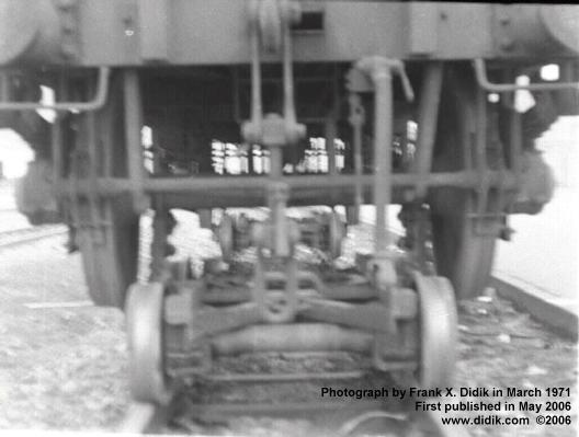
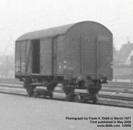
Today,
railroads employ various techniques to overcome this inconsistency
including the addition of undercarriage hubs. One example of how
conflicting gauges are dealt with is shown below in the photographs
shot by the author in 1971. Perhaps a better, automated solution will
be to use flat cars designed to use the global standard 40 foot (12
meters) and 20 foot (6 meter) shipping containers. These containers
will be loaded from one gauge flat car to another gauge flat car in a
matter of seconds.
Frank X.
Didik stated that he was amazed by the speed in which container ships
were loaded and unloaded,when he observed this in Bremerhaven,
Germany. Similar special technology can be engineered to do the same
with railroads. The Sakhalin Island has an advanced and extensive
rail system. Further, the Sakhalin Island region is very wealthy,
being one of the major oil producing regions of the world.
Cost
to build
The
cost to build the Trans Global Highway is minuscule when compared to
the enormous advantages that would emanate from its existence.
The
best estimate in 2012 is as follows:
In
2026, the following best cost estimates were determined:
-
For
the three tunnels comprising of the Amer-Asian Peace tunnel,
including Alaska to Little Diomede (25 miles/40km), Little Diomede to
Big Diomede (Russia - 2.5 miles/4km) and from Big Diomede to Siberia
(22 miles/37km), it was determined that the cost of construction
would be 85 Billion U.S. Dollars.
- The
Siberian connection of about 800 miles/1200km would be $30 million
U.S. Dollars per mile.
- The
Japan Sakhalin Siberia link would cost a best guess estimate of 45
Billion U.S. Dollars. This would include the Hokkaido-Sakhalin tunnel
19 miles/30km, and the Sakhalin to Siberia mainland of 5 miles/8km
- The
Spain-Morocco Gibraltar crossing would cost an estimated 18 Billion
U.S. Dollars.
- The
South East Asia to Australia would be the most expensive link,
comprising of 12 tunnels, with the longest being 14 miles across
relatively shallow water. Best estimate of total cost would be 140
Billion U.S. Dollars.
- The
Trans Global Highway will utilize existing roads and rails but they
will have to comply with a basic standardization. The cost estimate
for standardization is believed to be up to 175 Billion U.S. Dollars.
- The
total 2026 cost to build the complete Trans Global Highway is
believed to be accurately 680 Billion U.S. Dollars. While the price
may seem extraordinarily high, it must be remembered that the whole
world will benefit from this conduit and as a result of greatly
increased trade, the water pipelines allowing vastly more food
available and turning deserts into lush lands, the cost is minor. To
put it in proper perspective, the U.S. military budget in 2026 was
one trillion dollars, thus the cost to build the Trans Global Highway
is over 30% lower than one years military budget. Many of the
advanced technology companies who build military hardware will be
essential to the construction of the Trans Global Highway.
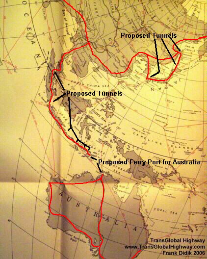
It is also technically possible to build a series of highways and
tunnels from South East Asia, island hoping from Malaysia, Indonesia
and continuing on to Australia, since the water between the various
islands to Port Darwin Australia is very shallow, being less than 200
meters, which is shallower than some existing waterway tunnels.
|
Example
of how the Russian gauge railroad cars
can
be made to run on European gauge track.
These
photographs were shot by the author in 1971 when he was just a child,
while
traveling in Wiebligen, western Germany, interested in model
electric trains.
Click
on any photograph to enlarge. Use your back key to return to this menu.
Click
to enlarge. Use your back key to return to this menu.
Other
methods of dealing with track gauges includes our patent pending
system of multi gauge track adjustment system as seen below.
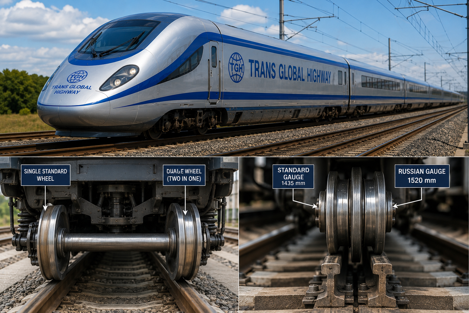
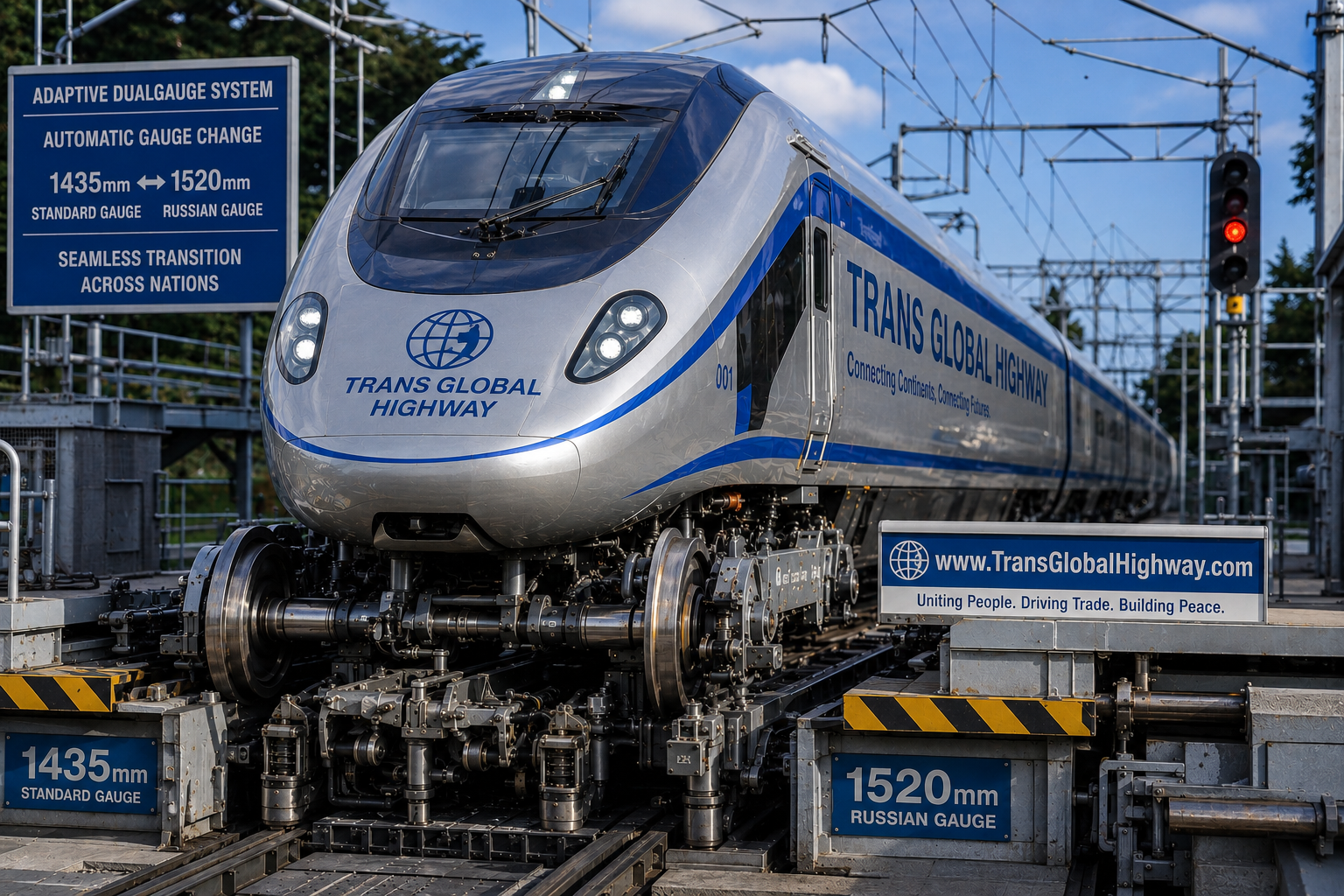 |
|
Dealing
with the snow
Much
of the arctic region has limited snowfall and can be controlled and
handled through conventional rail and road snow removal techniques.
In certain areas of high snow fall and accumulation, it may be
possible to construct steep roofed, prefabricated, inexpensive snow
roofs along the length of the effected track or road. In certain
areas, we may also opt to cover the Tracks and roadways of the Trans
Global Highway.
|
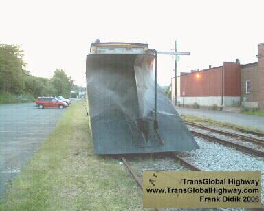
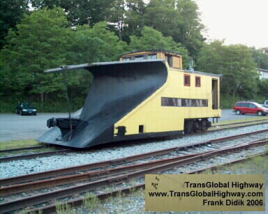
This is an old fashioned train
snow plow found in Honesdale Pennsylvania. |
Unlike this 100 year old train,
modern railroad snow removal trains employ snow blowers that run at
relatively high speeds. |
|
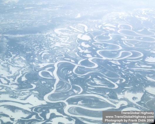
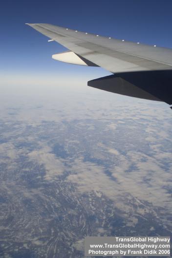
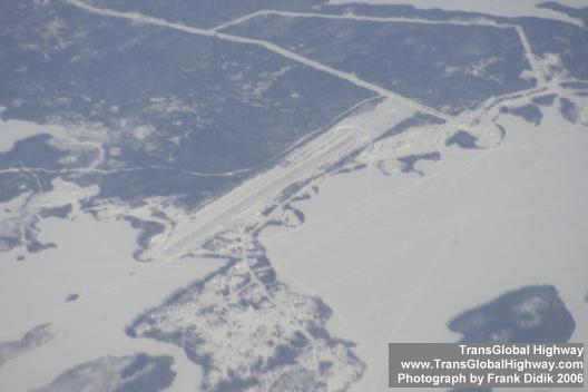
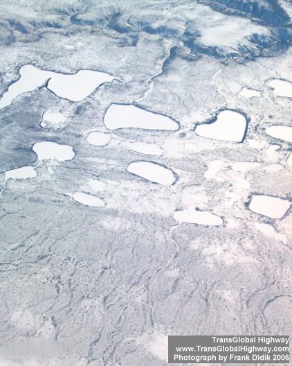
The
photographs below illustrate the terrain of norther Alaska and
Canada, where photographed by the author, while flying in a
commercial Airline from New York City to Japan, in February, 2003.
This seemingly harsh terrain in fact is crisscrossed by roads and
even small airports. The terrain in Alaska and Russia, around the
Bering Strait is slightly less rugged. Existing paved roads exist in
both Russia and Alaska within a few miles of the Strait. These roads
can be widened to form part of the Trans Global Highway. In the
summertime, much of this area is spectacularly green with tall grass.
It may be possible to encapsulate the expanded and enlarged roads and
rail links with a network of in-expensive overhead prefabricated protectors.
Click
on any photograph to enlarge. Use your back key to return to this menu.
|
|

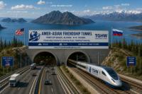
The proposed
AmerAsian Tunnel would link North America and Asia, across the Bering
Strait, for the first time in an estimated 9 thousand years. It would
create a highway, railroad, fresh water, oil and gas pipelines and
communication crossings.
From and
engineering perspective, the construction of the AmerAsian Tunnel is
straight forward without any particularly complex issues involved.
The Tunnel would comprise of 3 tunnels connecting Alaska and Russia
going through the Little and Big Diomede Islands.
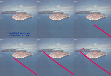
Little and Big
Diomede Islands showing path of proposed Bering Strait tunnels.


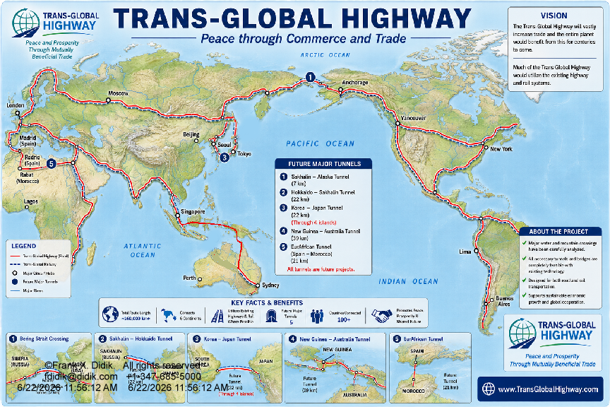
The TransGlobal
Highway would incorporate the existing railroads and highway networks
in each country. The illustrated path of the proposed TransGlobal
Highway would also have numerous other tributary roads.
The world as a
whole, would greatly greatly benefit from the TransGlobal Highway.
For example, Japan, in 2002, shipped 12 million metric tons of
finished goods to Europe, primarily by ocean. Some of the goods went
through the Suez Canal, while a portion of the goods also went around
South Africa. The shipping time from Yokohama to the European port of
Antwerp was in the order of 45 days. By rail, via the Trans Global
Highway, this time could be reduced to 12 days.


None of the major
tunnels that would have to be constructed for the TransGlobal Highway
would be particularly difficult to build. All of the tunnels would be
going through relatively shallow water. The tunnels can be
constructed in segments and than sunk and anchored to the bottom.
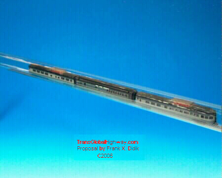

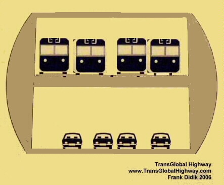
The proposed
segmented, prefabricated tunnels could provide for both vehicle as
well as rail transport, though with the potential complexity of
ventilation, a Chunnel approach may have to be taken, whereby the
vehicles are transported by electric powered railroad, through the
tunnel. Equally important, the Trans Global Highway would offer a
pathway for oil and gas pipelines, communication cables as well as
water pipelines to transport fresh water from areas of abundance to
arid areas.
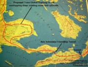
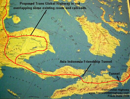
A series of long,
though not particularly difficult to construct tunnels is proposed to
be built linking Indonesia and Australia with the rest of Asia,
Europe and the world. This would be a huge advantage for global trade
and travel. It should be noted that in every case when a major bridge
or tunnel has been proposed, there are groups of people who have
argued that existing ferries and boats or out of the way roads were
good enough. The fact is that after such construction, everyone
immediately agreed that the bridge or tunnel was needed. Such
examples can be seen with the Chunnel, the Brooklyn Bridge, the
Varazono Narrows bridge and many other examples.
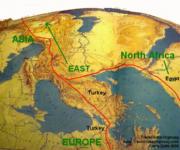
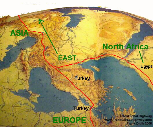
Turkey, which is
situated both in Asia and Europe, is presently linked to Europe via
two bridges. A third bridge is Presently at the beginning phases of construction.


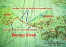
Closeup of the
proposed path of the AmerAsian Friendship Tunnel.
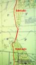
Closeup of the
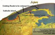
proposed path of the Sakhalin-Hokkaido Long Tunnel.
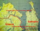
Closeup of the Sakhalin-Asia
Short tunnel that would connect the Sakhalin Island with Siberia
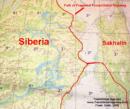
Expanded view of
the region surrounding the The proposed Sakhalin-Asia Short tunnel
|
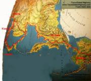
The construction
and use of the AmerAsian Tunnel would greatly reduce the overall cost
of transporting finished goods and raw materials to and from Europe,
Asia, North and South America.
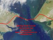
The Bering Strait
is very shallow with a maximum depth at the proposed tunnel crossing
of only 170 feet (52meters). The surface of the Bering Strait is
frozen some of the time. The tunnel could be constructed in segments
in factories and then sunk and assembled underwater. It could also be
construced using modern tunnel boring machines or TBM's.
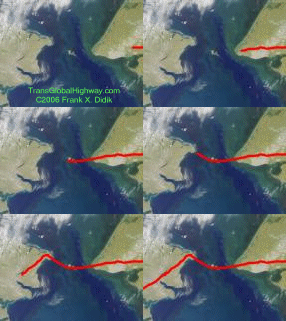

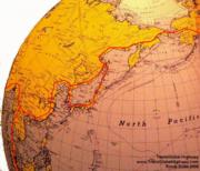
Existing roads may
have to be strengthened and or widened and brought up to a single
standard. The railroads of Russia are of a slightly wider gauge This
was designed to provide a greater footprint so that the rails would
not sink in the soft soil. Technologies exist for dual gauge train
cars. (Kindly see photographs of dual gauge trains, below).

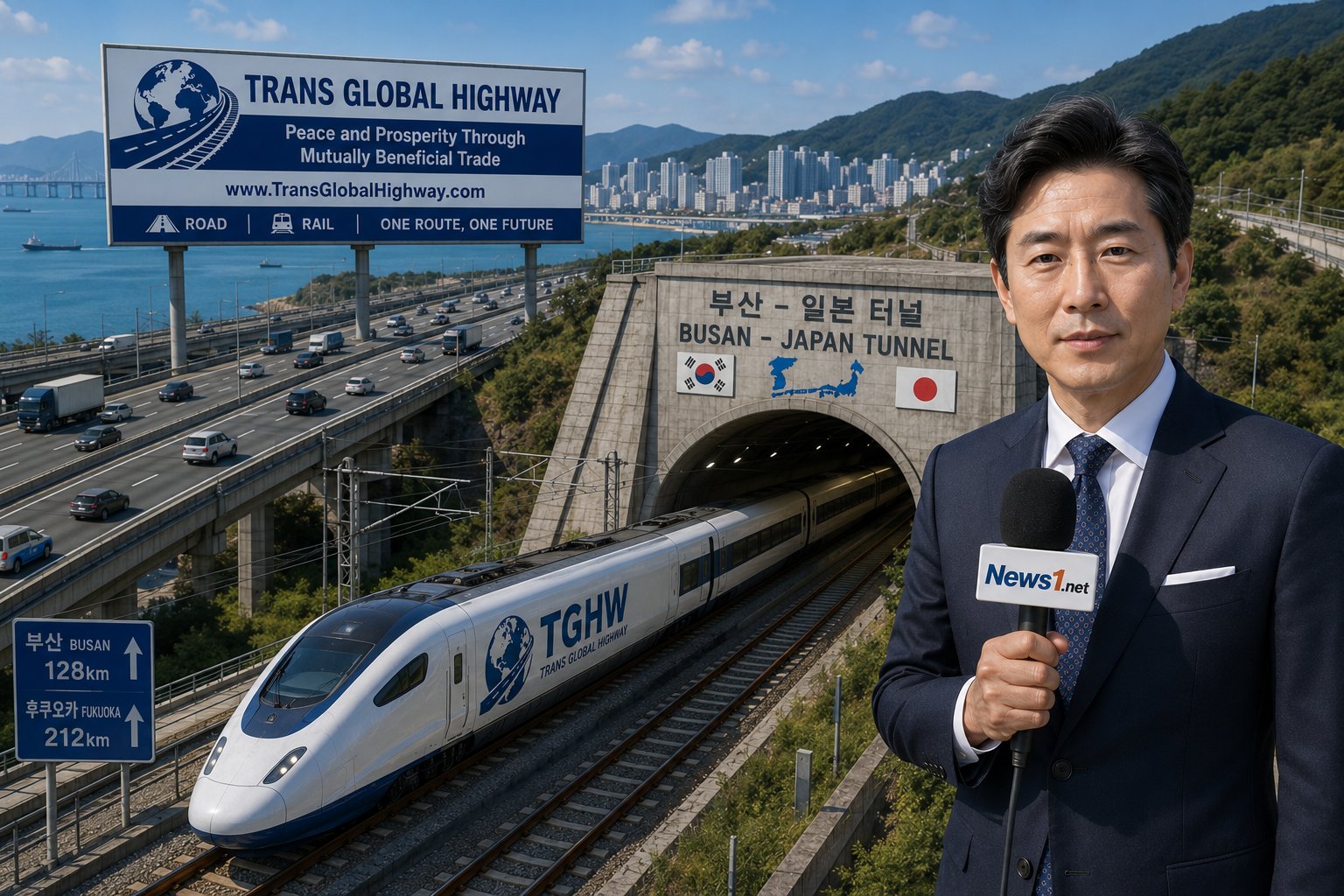
It is proposed
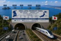
that two major tunnels be constructed to link Japan with Asia. These
being the Korea-Japan Friendship Tunnel and the Hokkaido to Sakhalin
Island-Asia Tunnel. These tunnels would thus quickly connect Japan
and the rest of the world to quickly and effectively transport people
and goods, at a minimal cost.
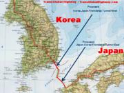
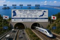


In
some cases, could in fact be suspended from the ocean floor, deep
enough not to be effected by adverse surface weather conditions. This
system is not envisioned nor needed for the proposed tunnels, however
this system could be employed if at such time, a tunnel was to be
constructed to link Australia to the rest of the world, between the
Cape of York Peninsula in Australia and Papua New Guinea or Darwin to
Timor, via Melville Island. (See below for more details).
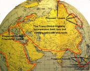
In a way, much of
the TransGlobal Highway already exists in local roads and highways
across the globe. The proposed TransGlobal highway would utilize the
existing transportation network, extending, widening and perhaps
strengthening it so that it forms a uniform global highway.
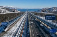
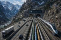
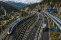
The
Trans-Global Highway would include:
1.
Road transport
2.
Robotic Railroads
3.
Oil and gas pipelines
4.
Electric and communication cables
5.
Fresh water pipelines could minimize the concern of flooding as
presented in the theory of global warming.
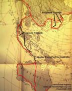
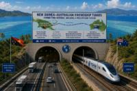
If a tunnel
was to be constructed to link Australia to the rest of the world,
between the Cape of York Peninsula in Australia and Papua New Guinea
(147km / 88.2 miles) or Darwin to Timor, via Melville Island (400km /
240miles). These incredibly long tunnels are not being proposed at
the present time, though it should be noted that the Swiss Gotthard
tunnel through the Alps, which is at the final stages of completion,
will be 35.7 miles / 59.60km long. Arguable, the Swiss tunnel, bored
through solid rock, is more difficult to construct than the potential
Australia-Papua New Guinea tunnel. Presently, a major seaport is
proposed to be constructed on Timor so to link Timor with Darwin and
the rest or Australia.
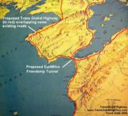
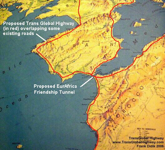
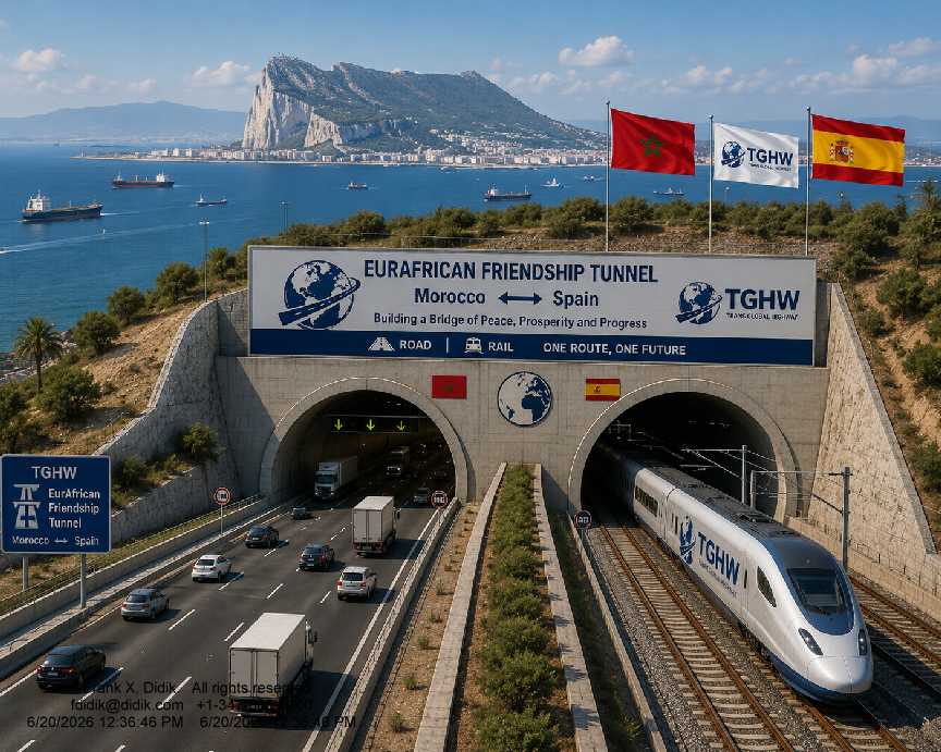
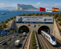
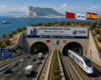
The concept of
linking Spain with Africa, in the area of Gibraltar has been dreamed
of and proposed, many times over the past thousand years. The
proposed EurAfrica Tunnel is an absolute must and is technically very
easy to accomplish. It would allow a vast amount of raw materials and
finished products to be sent back and forth between Europe, Africa
and the middle East.
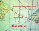
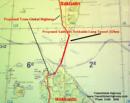
The AmerAsian
Friendship Tunnel would consist of 3 tunnels, with the longest being
23 km. The tunnel could be built in 10 years at an estimated cost of
5.5 Billion (thousand million) U.S. Dollars.
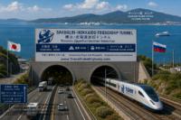
The
Sakhalin-Hokkaido Long Tunnel would be 42km long and could be
constructed in 9 years, at the cost of approximately 4.2 Billion
(thousand million) U.S. Dollars

The proposed Sakhalin-Asia
Short tunnel would be 7km (4.2 miles) long. It could be constructed
in 4 years at an estimated cost of 350 million U.S. Dollars.
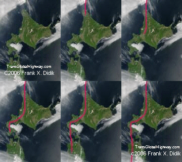
Proposed path of
the Sakhalin-Hokkaido Long Tunnel and the existing Seikan ocean
tunnel . |
Click
on any photograph to enlarge. Use your back key to return to this menu.
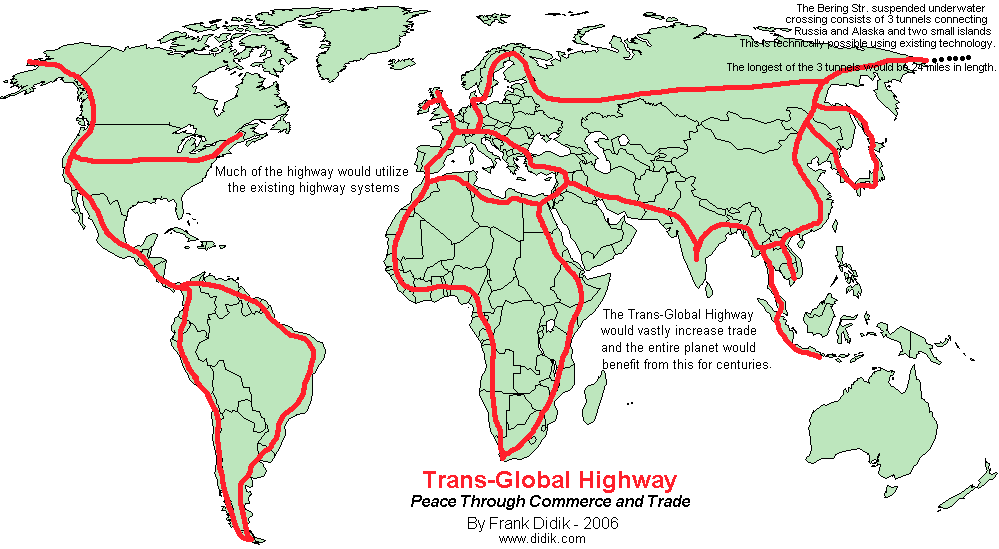
The
road outlines are tentative and are designed to utilize the existing
highway grid. Thus many more arteries than illustrated above, would
be connected to the backbone of the Trans Global Highway. Not clearly
shown in the map above is that North America and Asia are to be
connected by the Bering Strait Tunnel. NOTE: This has to be one of
the most copied Frank Didik maps on the internet. Many other maps has
used this map as their template.

This
illustration is based on the 1929 proposal to link Spain with
Africa, just south of Gibraltar. With some slight modifications, and
a much wider (though not longer) tunnel, Europe and Africa can
finally benefit quickly and easily from one another.
Global
Population I
realize that this a particularly touchy area and there are
overlapping reasons given for some of the population control
programs. In general, the reasons given for population control is
fear of a limited amount of resources and available energy and food supplies.
Rather than discouraging or restricting the formation of families in
order to stabilize or reduce population another approach would be to
let the population expand, without controls, and at the same time,
vastly expand available resources. Clearly the Trans Global Highway
would assist in greatly increased food production, clean water
supplies and rapid distribution of resources world wide.
There are vast areas of our planet that have an abundance of
resources of every variety, and yet these areas seem to isolated to
make proper use of. Construction of the Trans Global Highway will
change all of this since we will be able to get fresh water from
areas with huge reserves of fresh water, such as northern Canada and
Russia and pipe this water to areas with limited water supplies such
as central Russia, North Africa, and even to the western part of the
United States, that is presently rationing water to farms. Thus the
Trans Global Highway would increase available food supplies
worldwide. Further, transportation costs would be reduced and the
speed to transport heavy items would be increased, when compared to
ocean ship transport, thus low value cement or time dependent heavy
machinery could be quickly transported from one area of the world to
another. Such things as expensive mechanized farm equipment could be
utilized for one month in one area of the world and then shipped to
another area, with a different growing season. A large number of new
industries would be formed with massive economic opportunities.
Further, the entire planet would benefit with increase food supplies,
inexpensive electricity, and fuel and mineral resources could be
transported from isolated areas to urban areas.
If
we continue with the current direction of global population control,
we will end up with a stagnated medieval type of world, with very
little progress, and massively declining standards of living for all,
rich and poor. To restrict or reduce population, based on resources
available today and a very limited understanding of the future
availability of resources, will lead to nothingness. Already the
resulting decline in birthrates and aging populations has created
many new and unforeseen consequences. This includes a declining tax
base, a greater tax burden for the younger people, a greater
percentage of people required to take care of the elderly, declining
industrial output and a significant decline in the standard of living
for many young people.
Many people today still quote Thomas Robert Malthus's from the 18th
century and several others more recently, who predicted that society
would run out of resources and thus cause massive human starvation
and strife. The fact is that Thomas Robert Malthus's famous dire food
shortage predictions of 1798 and his subsequent books, over the next
30 years, failed to take into consideration modern advances in
farming, transportation, food storage and food abundance.
There
really is a better way for society, than to push population control.
The solution is simple. Have an international effort to build my
proposed Trans Global Highway.
The
Name is Confusing: It
was probably an error on my part many years ago, to name the project
"Trans-Global Highway" since most people associate the word
"highway" with a roadway, when in fact, I always viewed the
Trans-Global Highway as a pathway or a conduit for a variety of long
distance transporting needs including electric cables to send
electricity generated from distant places to urban areas,
communication cables, oil and gas pipelines as well as being a
pathway for high speed programmed trains and finally a roadway for
truck and car transportation. For extremely long range journeys, I
have always felt that the best way to transport goods would be using
programmed trains, rather than trucks, however for shorter trips,
such as between local cities or in relatively populated areas, trucks
and car would no doubt utilize the Trans-Global Highway.
A
note from Frank X. Didik who
originally conceived of the Trans Global Highway before the late
1980's and made a major push to make the Trans Global Highway a
reality in 2006.
STATEMENT:
"I am very pleased that the Tans Global Highway Development
Corporation was formed and is well on the way to securing the necessary
governmental, engineering, stakeholder acceptance and funding for
this truly amazing project that will help
the world in so many ways. The next 20 years will bring about
wonderful changes to the world and I am hopeful that I will still be
around in order to traverse
the entire Trans Global Highway."
"Over
the past 20 years, I have traveled around the world to many places
and have repeatedly flown over vast tracks of uninhabited areas of
Asia and North America. It is clear that the Trans Global Highway
will allow huge areas of resources to become accessible and this will
have the effect of vastly improving the lives of so many people and
as a consequence, will open up vast new areas of business that will
result in overall global progress."
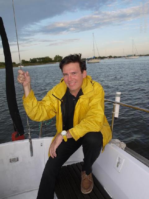
Frank X. Didik aboard his
sailboat"The Futurist", anchored in New York Harbor.
Part
of the original proposal by
Frank
X. Didik for the
Trans
Global Highway
"Peace and
prosperity for all through mutually beneficial trade"
By Frank X. Didik
May, 2006.
To read the
original Frank X. Didik proposal for the Trans Global Highway,
please go to: www.TransGlobalHighway.org
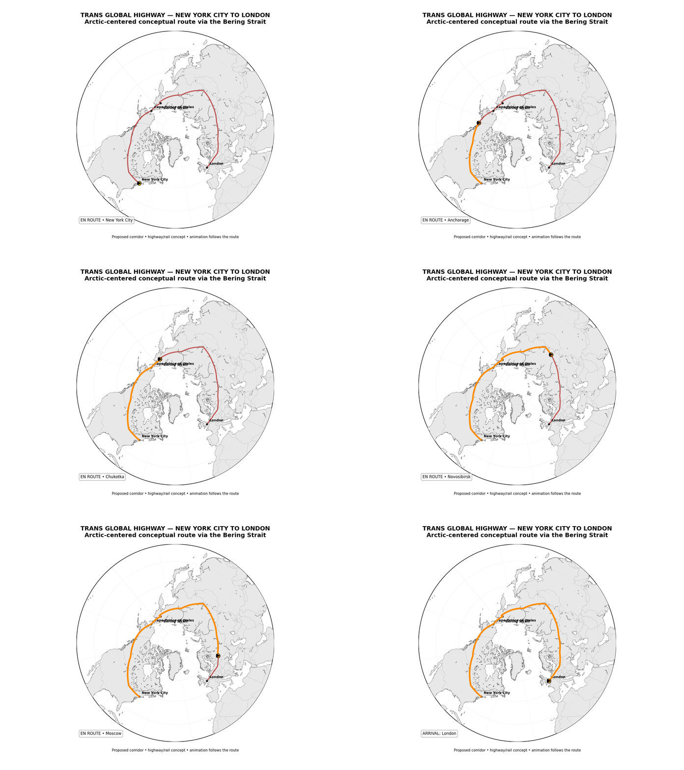
"I
would like to go from New York City to London. By car. Before the end
of my life, I would like to drive from New York City to Alaska and go
through the AmerAsian Peace Tunnel across the Bering Strait,
connecting the United States with Russia. From there, I plan to drive
south along the trans Siberia highway and cross under the bay from
Siberia to the Sakhalin Island (Russia), which is known for its
natural beauty and enormous mineral and gas reserves. From Sakhalin,
I will drive to Japan, via the Sakhalin-Hokkaido Friendship Tunnel
and then to the main Japanese island of Honshu through the 33.5 mile
/ 50km long Seikan ocean tunnel (built in 1988), and on to Tokyo.
From there I plan to go to southern Honshu and cross over the
(existing) bridge to the southern Japanese island of Kyushu and from
there, through the Korean-Japan Friendship Tunnel. Going through the
open borders of the Korea's, I plan to than drive through China,
India, Pakistan, Afghanistan, Iran, Iraq, Syria, Israel, Egypt and
all of north Africa to Morocco, where I plan to drive through the
EurAfrican Friendship Tunnel, ending in the southern tip of Spain,
just south of Gibraltar. From there, I plan drive north
to France and finally to England, via the 31.3 mile long
"Chunnel", which has a special train to carry automobiles
under the English Channel. I want to do this, in complete safety, through limited
or open borders".
I
admit that in today's world, what I have just described seems
utterly inconceivable; perhaps the unattainable dream of an idealist.
On the other hand, consider that in 1939, the thought of a completely
open Europe, without borders, would also have seemed totally
impossible. In August, 1989, who would have dreamed that in just one
month, the borders between "east" and "west"
Germany would be gone forever? Yet what seemed impossible is reality
today. The Trans Global Highway can and will eventually be
constructed, in one form or the other
and will ultimately enhance global understanding, mutually beneficial
trade and to bring society closer together.
... Frank X. Didik, New York City, May, 2006
NOTE: Besides
naming the Trans Global Highway, Mr. Didik also created the names:
-
Trans
Global Highway
- AmerAsian
Friendship Tunnel
- Korea-Japan
Friendship Tunnel
- Sakhalin-Hokkaido
Friendship Tunnel
- EurAfrican
Friendship Tunnel
In
2008, Mr Didik also filed for a U.S. Trade Mark for the Trans Global
Highway. Details about this can be found at the USPTO.gov website.
In
the late 1980's and early 1990's, Mr Didik used the term "Peace
Tunnels". From 1989 to 1993, he had organized a major project to
bring about peace between then Eastern Europe and the former USSR
through mutually beneficial trade. So as a result, the Trans Global
Highway was a natural progression.
Today,
in 2026, all of Mr. Didik's tunnel names and the maps that he
created are commonly used to describe the Trans Global Highway,
though often times, he is not given credit for them. |
Please
share this project on
and






























|